Fundata
Surrounded by the Bucegi Mountains and the Piatra Craiului Mountains, Fundata's altitude of 1360 m makes it the highest commune in Romania. Șirnea was first attested in 1729, and Fundata in 1732. It lies on the southern border of Brașov County, with Argeș County on the other side, in the middle of the Rucăr-Bran Pass, along European route E574. It is 42 km from Brașov and 26 km from Râșnov.
In August 1916, when troops from the Romanian Old Kingdom entered Austria-Hungary, the first village they took was Fundata, also capturing their first prisoners there and suffering their first battle death.
A traditional lifestyle of herding sheep and cows is preserved, augmented by tourism. Indeed, Șirnea was declared the country's first tourist village in 1968. Aside from the mountainous scenery, attractions in Fundata include a wooden Romanian Orthodox church (1830) and one of stone (1939–1943); in Șirnea, there is a church from 1893–1894 as well as an ethnographic museum. There is an annual festival held around July 20, feast of the prophet Elijah, called Nedeia Munților ("Mountain Celebration"). Originally a "feast of two countries" (Transylvania and Wallachia), it was revived in 1969, and features folklore displays as well as local cheeses and meats.
At the 2011 census, all but one of the commune's inhabitants were ethnic Romanians.
Map - Fundata
Map
Country - Romania
 |
 |
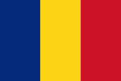
| Flag of Romania | |
Europe's second-longest river, the Danube, rises in Germany's Black Forest and flows southeasterly for 2857 km, before emptying into Romania's Danube Delta. The Carpathian Mountains cross Romania from the north to the southwest and include Moldoveanu Peak, at an altitude of 2544 m.
Currency / Language
| ISO | Currency | Symbol | Significant figures |
|---|---|---|---|
| RON | Romanian leu | lei | 2 |
| ISO | Language |
|---|---|
| HU | Hungarian language |
| RO | Romanian language |


